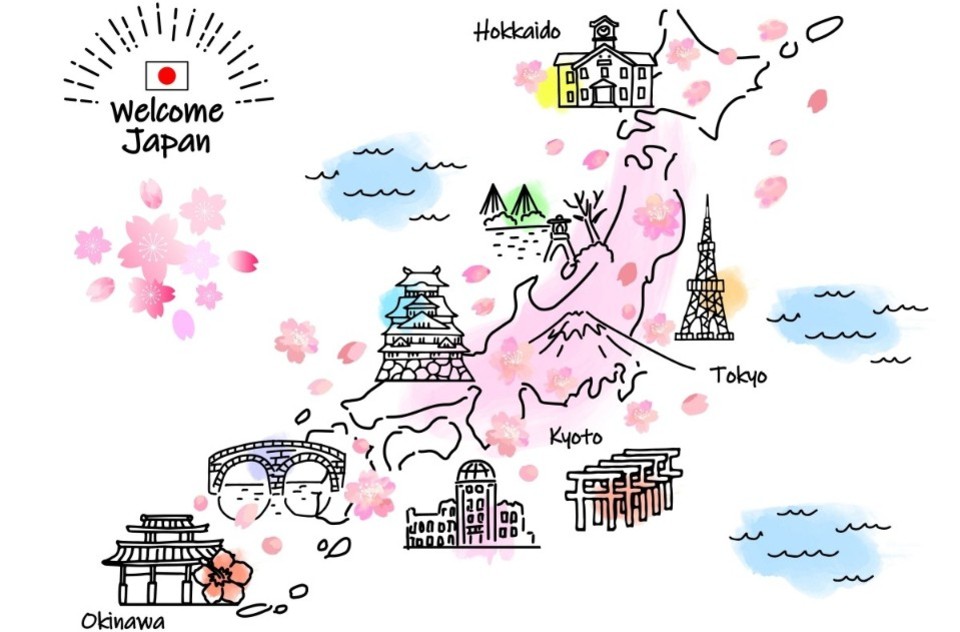
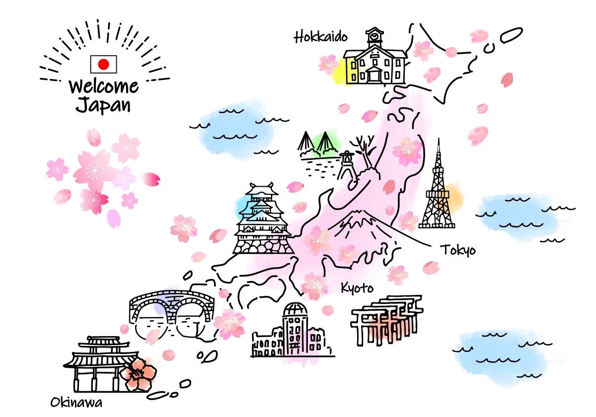
Have you ever looked at a map of Japan, an essential tool when traveling around the country? Japan stretches long from north to south, and its territory is made up of four main islands: Hokkaido, Honshu, Shikoku, and Kyushu.
These four islands are home to 47 prefectures, including world-famous cities such as Tokyo, the metropolis; Osaka, known for its food and entertainment; and Fukuoka, a bustling gateway to Asia.
In this article, a writer living in Japan and well-versed in Japanese geography will guide you through the map of Japan, introducing the charms of each region and recommended sightseeing spots in an easy-to-understand way!
All of Japan on the Map | Is Tokyo Located on Honshu?
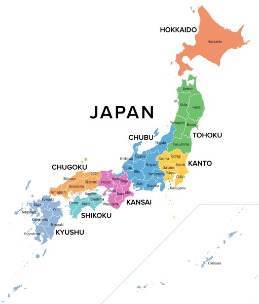
The Japanese archipelago stretches long from north to south, with Honshu occupying the largest area. To its north lies Hokkaido, known for its vast natural landscapes and cool climate. Hokkaido is a popular tourist destination, famous for its local specialties found only in northern Japan.
At the northernmost part of Honshu is the Tohoku region, an area rich in nature that changes beautifully with the seasons. Like Hokkaido, the Sea of Japan side of Tohoku experiences heavy snowfall in winter. South of Tohoku is the Kanto region, home to Tokyo, the political and economic center of Japan.
The Chubu region is located in the center of Honshu, featuring many mountainous areas where the majestic Japanese Alps stand alongside bustling cities. To the west is the Kansai region, which includes Kyoto, Osaka, and Nara—cities that once served as the capital and are renowned for their history and traditional culture.
The Chugoku region is made up of two areas with contrasting climates: the warm Seto Inland Sea side (Sanyo) and the cold, snowy Sea of Japan side (Sanin). Next to it is Shikoku, the smallest of Japan’s four main islands. Southeast of Honshu is Kyushu, a region known for its many volcanoes and hot springs.
By the way, famous cities such as Tokyo, Osaka, Nagoya, and Hiroshima are all located on Honshu.
Travel Map of Hokkaido, Japan | Must-Visit Sightseeing Spots
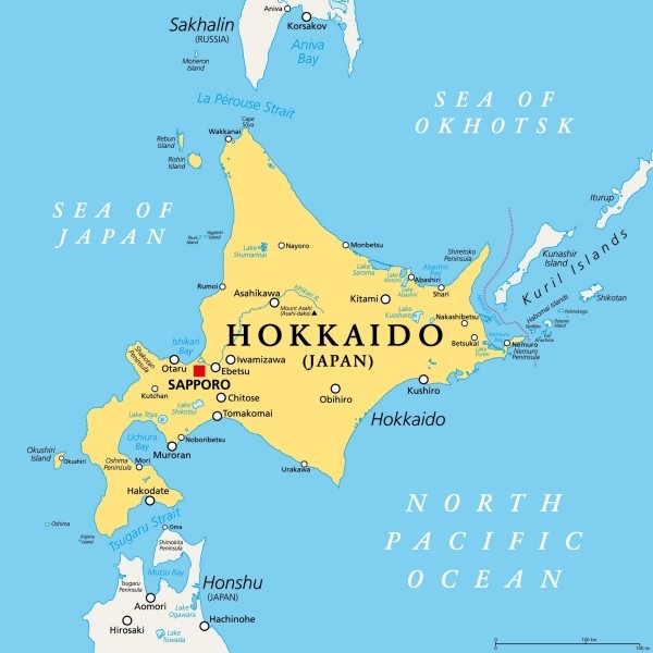
Located at the northernmost tip of Japan, Hokkaido is the largest of the 47 prefectures. Even in summer, the weather is cool and comfortable, making it a popular destination for travelers seeking a refreshing escape. In winter, heavy snowfall attracts visitors from around the world looking to enjoy powder snow and winter sports.
Hokkaido is home to many attractive sightseeing spots. In summer, you can enjoy the lavender fields of Furano and the vast natural landscapes, while in winter, ski resorts such as Niseko are world-renowned for their excellent snow quality.
There are also hot springs surrounded by nature, such as Noboribetsu Onsen and Jozankei Onsen. In addition, Hokkaido is famous for its seafood, especially crab, scallops, and salmon, which are especially popular among visitors.
Travel Map of Hokkaido, Japan | List of Recommended Sightseeing Spots
| Area | Major Sightseeing Spots |
| Sapporo | Odori Park, Sapporo TV Tower, Susukino |
| Otaru | Otaru Canal, Sakaimachi Street, Mt. Tengu |
| Hakodate | Mt. Hakodate, Goryokaku, Kanemori Red Brick Warehouse |
| Furano & Biei | Farm Tomita (Lavender Fields), Shikisai-no-Oka |
| Asahikawa | Asahiyama Zoo, Ueno Farm |
| Noboribetsu | Noboribetsu Onsen, Jigokudani (Hell Valley) |
| Lake Toya | Lake Toya Onsen, Mt. Usu |
| Niseko | Niseko Ski Resort, Mt. Yotei |
| Shiretoko | Shiretoko Five Lakes, Shiretoko Cape |
| Kushiro | Kushiro Marsh, Lake Akan, Lake Mashu |
💡Click here if you want to read a detailed article
Travel Map of the Tohoku Region of Japan | Must-Visit Major Tourist Spots
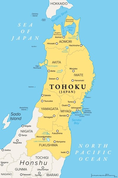
The Tohoku region is located in the northern part of Honshu, Japan’s main island, and consists of six prefectures: Aomori, Iwate, Miyagi, Akita, Yamagata, and Fukushima.
The Ou Mountains run north to south through the center of the region, and the climate differs greatly between the Sea of Japan side and the Pacific Ocean side, divided by this mountain range. In particular, the Sea of Japan side is known for some of the world’s heaviest snowfall in winter, while the Pacific side is characterized by many sunny days.
Surrounded by rich nature and steeped in history, the region is dotted with numerous tourist attractions that fascinate visitors. Notable examples include Chuson-ji Konjikido in Hiraizumi, Iwate Prefecture, the UNESCO World Natural Heritage Site of Shirakami Sanchi, which spans Aomori and Akita Prefectures, and the Tohoku Three Great Festivals such as the Aomori Nebuta Festival in summer.
In winter, nostalgic streets covered in snow at Ginzan Onsen in Yamagata and the high-quality snow at Zao are also popular. the natural scenery that changes beautifully with each season, historic buildings and hot springs, and beautiful snowy landscapes offer the unique and profound charm of Tohoku.
Travel Map of the Tohoku Region of Japan | Recommended Tourist Spots List
| Prefecture | Major Tourist Spots |
| Aomori | Hirosaki Castle, Shirakami Sanchi, Sannai-Maruyama Site |
| Iwate | Chuson-ji Konjikido (Hiraizumi), Genbikei Gorge, Ryusendo Cave |
| Miyagi | Matsushima, Sendai Castle Ruins, Zuihoden Mausoleum |
| Akita | Samurai District of Kakunodate, Lake Tazawa, Yokote Kamakura |
| Yamagata | Ginzan Onsen, Yamadera (Risshaku-ji Temple), Zao Snow Monsters |
| Fukushima | Ouchi-juku, Tsuruga Castle, Goshikinuma Ponds |
💡Click here if you want to read a detailed article
Travel Map of the Kanto Region of Japan | Must-Visit Major Tourist Spots
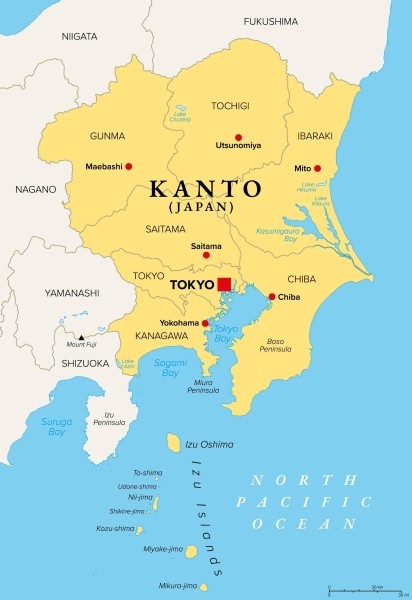
The Kanto region is located slightly north of the center of Japan and consists of Tokyo, Kanagawa, Chiba, Saitama, Ibaraki, Tochigi, and Gunma (one metropolis and six prefectures).
This region features a unique geography, with mountains to the north and west, the Pacific Ocean to the east and south, and the Kanto Plain spreading across the center. The climate also follows the terrain: the Pacific side has little temperature variation and is hot and humid in summer, while the inland areas are characterized by large temperature changes both seasonally and throughout the day.
In the mountainous areas in the north, temperatures remain low throughout the year, making summers cool and snowfall in winter not uncommon.
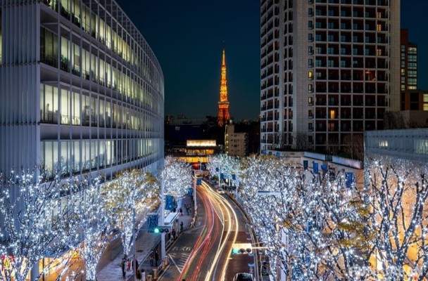
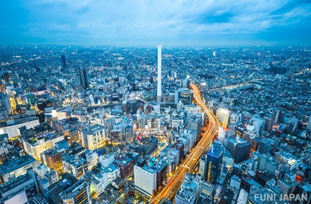
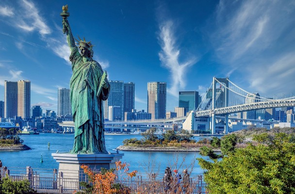
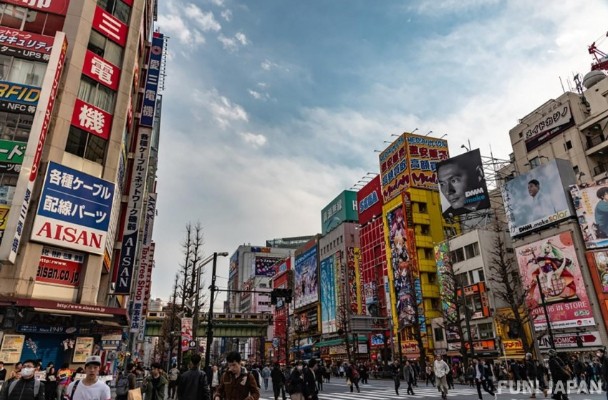
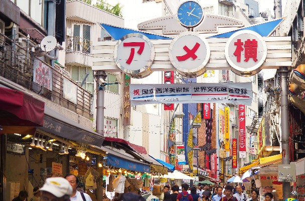
Major tourist attractions include urban spots such as Tokyo Skytree®, Minato Mirai 21 in Yokohama, and Tokyo Disneyland in Chiba. There are also places to enjoy history and culture, such as Senso-ji Temple in Tokyo and Nikko Toshogu Shrine in Tochigi, as well as hot spring resorts like Kusatsu Onsen in Gunma and Hakone in Kanagawa. The region is attractive for its blend of urban convenience, rich nature, and history.
Travel Map of the Kanto Region of Japan | Recommended Tourist Spots List
| Prefecture/Metropolis | Major Tourist Spots |
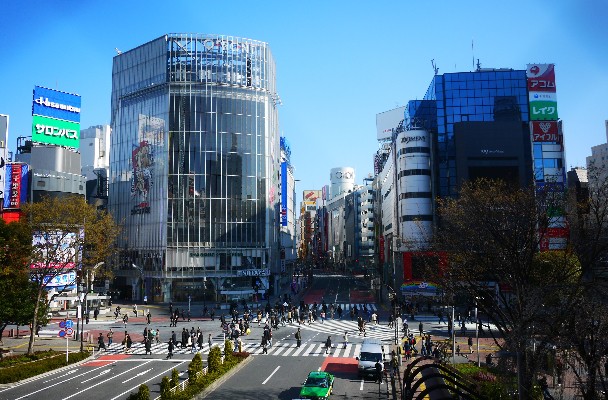
| Tokyo | Senso-ji Temple, Tokyo Tower, Shibuya Scramble Crossing |
| Kanagawa | Yokohama Minato Mirai 21, Hakone, Great Buddha of Kamakura |
| Chiba | Tokyo Disneyland®, Tokyo DisneySea®, Naritasan Shinshoji Temple |
| Saitama | Kawagoe, Nagatoro Gorge, Railway Museum (Omiya) |
| Ibaraki | Hitachi Seaside Park, Fukuroda Falls, Kashima Shrine |
| Tochigi | Nikko Toshogu Shrine, Kegon Falls, Kinugawa Onsen |
| Gunma | Kusatsu Onsen, Ikaho Onsen, Tomioka Silk Mill |
💡Click here if you want to read a detailed article
Travel Map of Japan's Chubu Region (Hokuriku)|Must-Visit Major Tourist Spots
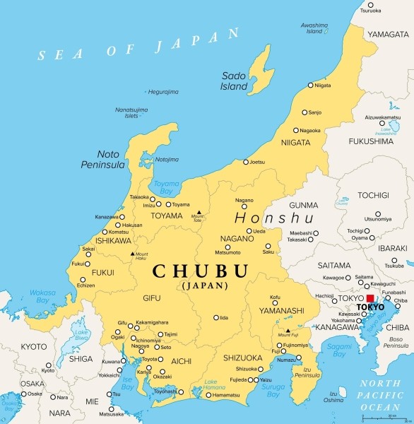
The Chubu region is located in the center of Honshu and consists of nine prefectures: Niigata, Toyama, Ishikawa, Fukui, Yamanashi, Nagano, Gifu, Shizuoka, and Aichi.
The most distinctive feature of the Chubu region's geography is that the central area is divided by the 3,000-meter-class Japanese Alps. As a result, the climate also varies: the area from the Japanese Alps to the Pacific side is warm with heavy rainfall in summer, while the Sea of Japan side experiences some of the world's heaviest snowfall in winter, creating beautiful snowy landscapes.
Among the representative tourist spots in the Chubu region are Nagoya Castle and Atsuta Shrine in Aichi, which convey a sense of historical grandeur, and Kenrokuen in Kanazawa, one of Japan's three most famous gardens.
Additionally, the region is home to many spectacular sights, such as the UNESCO World Heritage Sites of Shirakawa-go (Gifu) and Gokayama (Toyama), where traditional gassho-zukuri villages remain, as well as Mount Fuji, the symbol of Japan.
Travel Map of Japan's Chubu Region|List of Recommended Tourist Spots
| Prefecture | Major Tourist Spots |
| Niigata | Echigo Yuzawa Onsen, Sado Island, Naeba Ski Resort |
| Toyama | Tateyama Kurobe Alpine Route, Amaharashi Coast, Gokayama |
| Ishikawa | Kenrokuen, Higashi Chaya District, Kaga Onsen |
| Fukui | Tojinbo Cliffs, Eiheiji Temple, Dinosaur Museum |
| Yamanashi | Mount Fuji, Fuji Five Lakes, Oshino Hakkai |
| Nagano | Kamikochi, Matsumoto Castle, Karuizawa |
| Gifu | Shirakawa-go, Hida Takayama, Gero Onsen |
| Shizuoka | Fujisan Hongu Sengen Taisha Shrine, Atami Onsen, Miho no Matsubara |
| Aichi | Nagoya Castle, Atsuta Shrine, Inuyama Castle |
💡Click here if you want to read a detailed article
Travel Map of Japan's Kansai Region|Must-Visit Major Tourist Spots
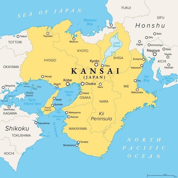
The Kansai region is located to the west of the Chubu region and consists of two prefectures and five other prefectures: Osaka, Kyoto, Hyogo, Nara, Shiga, Wakayama, and Mie.
One of the geographical features is that it is surrounded on three sides by the Pacific Ocean, the Sea of Japan, and the Seto Inland Sea. The region is also characterized by basins and plains surrounded by mountains, which bring a variety of climates to each prefecture. Generally, the region has a mild and comfortable climate, but the Sea of Japan side gets a lot of snow in winter, and the area around the Kii Mountains, one of Japan's rainiest areas, is warm and receives a lot of rainfall.
One of the charms of the Kansai region is that it has been the cultural heart of Japan for over 1,000 years. As a result, you can find many historic temples and shrines, such as the Great Buddha Hall of Todai-ji in Nara, the world's largest wooden structure, and Fushimi Inari Taisha in Kyoto, famous for its beautiful vermilion torii gates.
Other highlights include the lively Dotonbori in Osaka and the UNESCO World Heritage Site Himeji Castle in Hyogo. The Kansai region is truly a treasure trove of diverse tourist attractions.
Travel Map of Japan's Kansai Region|List of Recommended Tourist Spots
| Prefecture | Major Tourist Spots |
| Osaka | Dotonbori, Osaka Castle, Universal Studios Japan |
| Kyoto | Fushimi Inari Taisha, Kiyomizu-dera, Arashiyama |
| Hyogo | Himeji Castle, Arima Onsen, Kobe |
| Nara | Todai-ji, Nara Park, Kasuga Taisha |
| Shiga | Lake Biwa, Hikone Castle, Shirahige Shrine |
| Wakayama | Mount Koya, Kumano Nachi Taisha, Shirahama Onsen |
| Mie | Ise Jingu, Toba Aquarium, Nagashima Spa Land |
💡Click here if you want to read a detailed article
Travel Map of the Chugoku Region in Japan | Must-Visit Major Tourist Spots
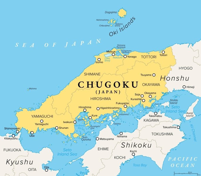
The Chugoku region is located in the western part of Honshu and consists of five prefectures: Tottori, Shimane, Okayama, Hiroshima, and Yamaguchi.
The defining feature of the Chugoku region’s geography is the Chugoku Mountains running through the center, dividing the area into San’in in the north and Sanyo in the south. In San’in, which faces the Sea of Japan, you can see diverse natural landscapes such as the majestic Mt. Daisen and the Tottori Sand Dunes, one of the largest in Japan. In Sanyo, which faces the Seto Inland Sea, you can enjoy island hopping. The climate also varies greatly due to the terrain: San’in is known for its cold winters with snowy scenery, while Sanyo is characterized by its mild weather and many sunny days.
For sightseeing, there are many attractions such as Hiroshima’s Itsukushima Shrine and Atomic Bomb Dome, both World Heritage Sites, the beautiful canals of the Kurashiki Bikan Historical Quarter in Okayama, and Izumo Taisha Grand Shrine in Shimane. These spots, where deep history and nature blend together, continue to fascinate visitors to Japan.
Travel Map of the Chugoku Region in Japan | Recommended Tourist Spots List
| Prefecture | Major Tourist Spots |
| Tottori | Tottori Sand Dunes, Mizuki Shigeru Road, Mt. Daisen |
| Shimane | Izumo Taisha Grand Shrine, Matsue Castle, Iwami Ginzan Silver Mine |
| Okayama | Kurashiki Bikan Historical Quarter, Okayama Korakuen Garden, Kibitsu Shrine |
| Hiroshima | Itsukushima Shrine (Miyajima), Atomic Bomb Dome, Peace Memorial Park |
| Yamaguchi | Tsunoshima Bridge, Akiyoshidai Plateau, Motonosumi Shrine |
💡Click here if you want to read a detailed article
Travel Map of the Shikoku Region in Japan | Must-Visit Major Tourist Spots
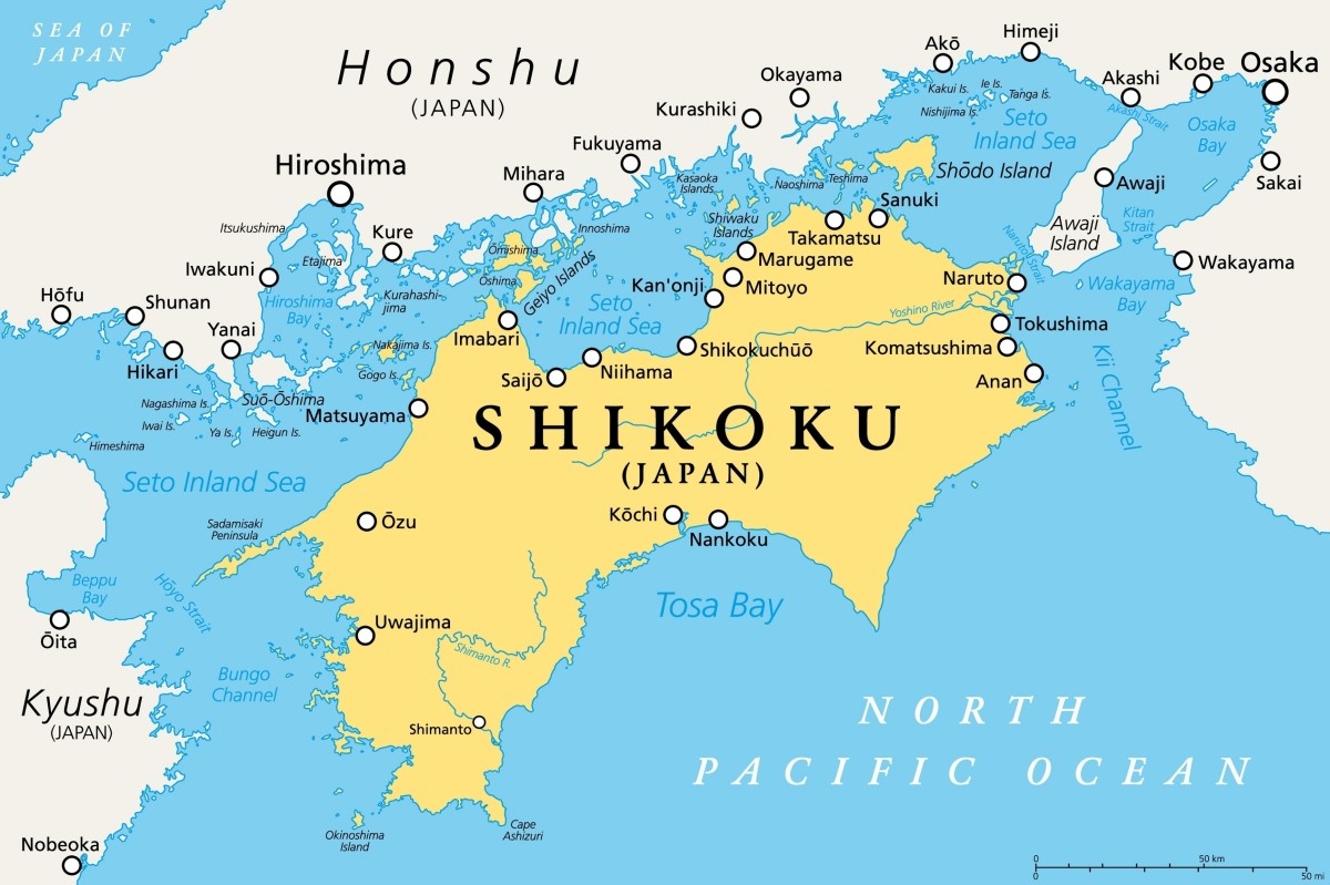
The Shikoku region is located south of the Chugoku region of Honshu and consists of four prefectures: Tokushima, Kagawa, Ehime, and Kochi.
Shikoku is the smallest of Japan’s four main islands and is connected to Honshu by bridges such as the Seto Ohashi Bridge (Kagawa) and the Shimanami Kaido (Ehime). The terrain features the rugged Shikoku Mountains running east to west through the center, with the calm Seto Inland Sea to the north and the vast Pacific Ocean to the south. The climate varies greatly depending on the side of the mountains: the Seto Inland Sea side is warm with little rainfall, while the Pacific side is affected by the Kuroshio Current and typhoons, making it one of the rainiest areas in Japan.
Major tourist spots include Dogo Onsen in Ehime, which has a history of about 3,000 years, Matsuyama Castle with its original keep, and Shodoshima in Kagawa, famous for olive cultivation and contemporary art.
Travel Map of the Shikoku Region in Japan | Recommended Tourist Spots List
| Prefecture | Major Tourist Spots |
| Tokushima | Naruto Whirlpools, Otsuka Museum of Art, Iya Kazurabashi Bridge |
| Kagawa | Shodoshima, Kotohira-gu Shrine, Ritsurin Garden |
| Ehime | Dogo Onsen, Matsuyama Castle, Shimanami Kaido |
| Kochi | Katsurahama Beach, Kochi Castle, Shimanto River |
💡Click here if you want to read a detailed article
Travel Map of the Kyushu & Okinawa Region in Japan | Must-Visit Major Tourist Spots
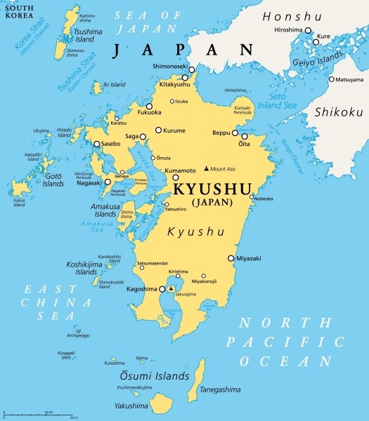
Located in the southwestern part of the Japanese archipelago, the Kyushu region is made up of seven prefectures: Fukuoka, Saga, Nagasaki, Oita, Kumamoto, Miyazaki, and Kagoshima. Sometimes, the outlying islands southwest of Kyushu, including Okinawa, are also considered part of this region.
Kyushu is the third largest island among those that make up Japan, situated south of the western tip of Honshu. The most distinctive features of its landscape are its volcanoes and hot springs. You can enjoy dynamic scenery such as Mount Aso (Kumamoto), which boasts one of the world’s largest calderas, and Sakurajima (Kagoshima), which still emits volcanic smoke almost daily. The climate is generally mild, but rainfall increases significantly during the rainy season and typhoon season.
Popular tourist destinations include the yatai (street food stalls) districts of Nakasu and Tenjin in Fukuoka, Beppu Onsen in Oita—one of Japan’s top hot spring resorts in terms of water output—and the mythical Takachiho Gorge in Miyazaki. Including Okinawa, where you can enjoy beautiful beaches and a subtropical maritime climate, the region is packed with a wide variety of attractions.
Travel Map of Kyushu, Japan | Recommended Tourist Spots
| Prefecture | Main Tourist Attractions |
| Fukuoka | Nakasu Yatai District, Dazaifu Tenmangu Shrine, Itoshima |
| Saga | Arita Porcelain Village, Yoshinogari Historical Park, Ureshino Onsen |
| Nagasaki | Huis Ten Bosch, Glover Garden, Gunkanjima (Battleship Island / Hashima Island) |
| Oita | Beppu Onsen, Jigoku Meguri (Hell Tour), Yufuin Onsen |
| Kumamoto | Mount Aso, Kumamoto Castle, Kurokawa Onsen |
| Miyazaki | Takachiho Gorge, Aoshima Shrine, Nichinan Coast |
| Kagoshima | Sakurajima, Yakushima, Ibusuki Onsen |
💡Click here if you want to read a detailed article
Travel All 47 Prefectures of Japan with This Complete Travel Map!
As you can see from the geography, climate, and major tourist destinations, Japan’s 47 prefectures are filled with fascinating attractions. All that’s left is to visit them yourself. Extraordinary experiences beyond your imagination are waiting for you.


Comments