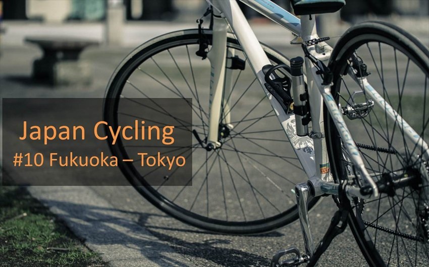
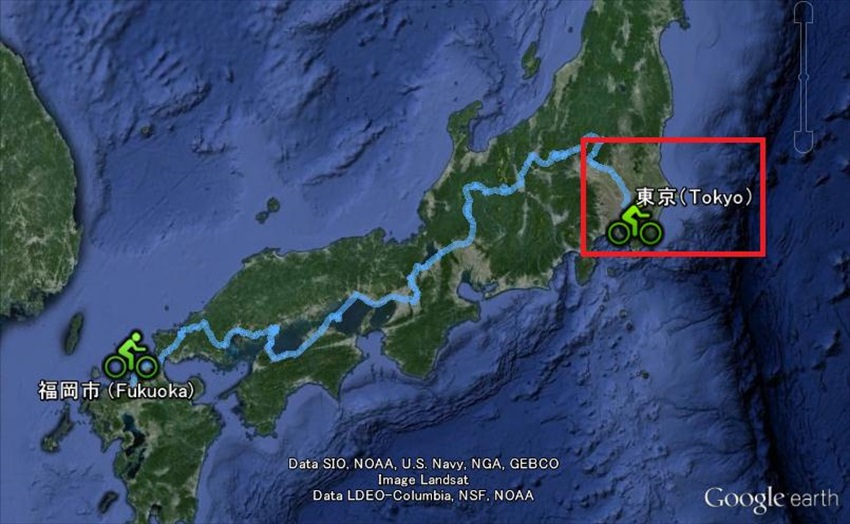
This is FINAL episode, Almost goal!! 1930km!? What can you imagine this figure. It’s a distance which one traveler moved by bike between Fukuoka and Tokyo of Japan. Let me share the routes guide and attractions between Fukuoka and Tokyo several times.
Today let me share the routes between Nikko - Tokyo.
Nobody would doubt it’s a very long journey for Tokyo as below.
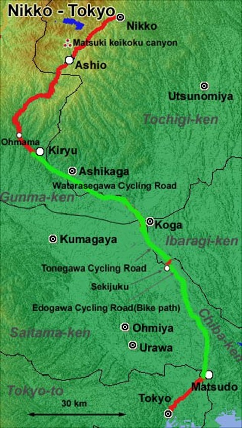
【Summary】
Route: Nikko-Kiryu-Sekiyado-Tokyo
Total distance: 189km
Best Season: Spring-Fall
Steepness : ★ (little)
Natural Beauty : ★★★(plenty)
History : ★(little)
Traffic : ★(little)
【Details】
■Copper road:Hosoo Pass
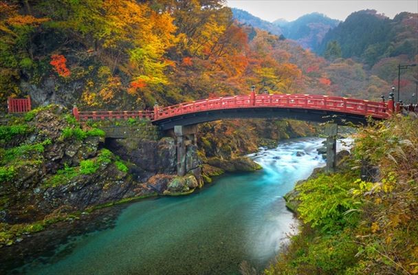
After visiting Toshogu, go back about 7km in the direction of Irohazaka. This will enable you to escape the Nikko area, by climbing over Hosoo Pass (細尾峠).
Zoom At first, cross Hsoo-ootani Bashi Bridge (細尾大谷橋) to take the R122. Then R122 forks. Take the right-hand road. This is the old R122 route which offers little traffic and pleasant rural scenery.
Soon pass under the bridge of "new" R122. Next to it, cross the bridge again while, this time, looking down on the "new" R122. Make sure you don't wander onto this "new" R122 which leads to a 2.7 km long tunnel.
Hosoo Pass is frequently closed to traffic due to fallen snow. In winter, you are supposed to run through the long tunnel on the "new" R122.
Old Hosoo Pass was the arterial road between Nikko and Ashio until quarter-century ago. Many people of Ashio Town carried the copper to Nikko over the Hosoo Pass road. It was the material used for the beautiful architecture of Nikko. Thanks to this former traffic, this road is wide enough, as yet and not so steep, considering it had been constructed prior to the motorization age.
■Kiryu City
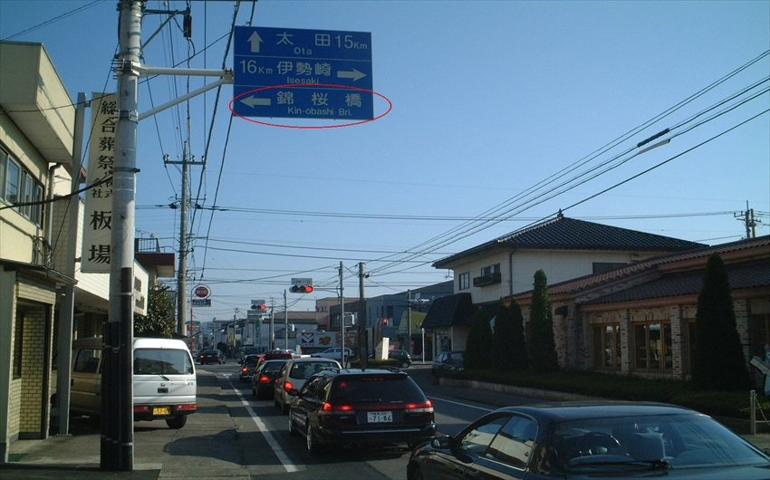
Continue on the R122 to Kiryu (桐生) City. R122 is not always straight, so we have to turn left and right several times. Be guided by the signboards showing "122". After entering Kiryu City, 8 km away from border between Oomama (大間々) City and Kiryu City, a signboard indicates Kin-obashi Bridge (錦桜橋). Turn left as shown by the signboard, then cross Kin-obashi Bridge.
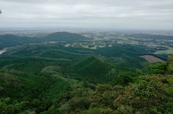
Now we're standing at a gateway to the broad Kanto Plain (関東平野). It has large population. About 30 per cent of Japanese people live here. Also, traffic is heavy. To avoid a traffic jam, we suggest using a major bike path – an exclusive road for bicycles. This route is much longer than taking R122 to Tokyo, but much safer, more scenic, and definitely much more fun.
Remember that these bike paths can be confusing. Even Japanese cyclists are easy to be lost. You will l have to cross a lot of bridges, looking out for them, but we promise you an amazing ride.
Our paved bike path starts from the east side of Kin-obashi bridge, and extend to the southeast. Here, enjoy non-stop riding! But look out for, and Give Way to pedestrians and walkers. They cross the bike path at times. (Right-hand picture is the entrance of the bike path at Kin-obashi bridge.)
It is 3.5 km from Kin-obasni bridge (about 600 m short of Matsubara Bashi Bridge (松原橋)), there is confusing cross-point. Be guided by the indicators in the left-hand picture.
At Matsubara bridge, take the left-hand road to go under the bridge.
■R6
Take the R6 to the west. This road takes you to the middle of Tokyo via Asakusa. R6 is, of course, a busy road but the road is wide enough. Follow the signboards that saying "6" and city names, such as Asakusa(浅草) and Nihonbashi(日本橋). Once more you need to cross the bridge, Kototoi Bashi (言問橋) as turning to the right. After crossing the bridge, turn to the left as shown by the signboard.
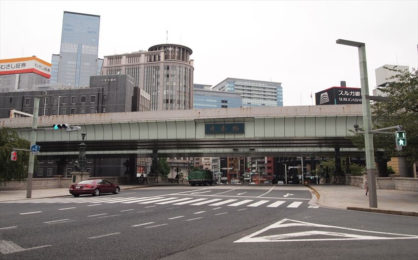
The final destination of this "Length of Japan" Part 1 is Nihonbashi Bridge(日本橋). That has remained as the origination of all roads of Japan for 400 years. You might come across signboard that said "Nihonbashi (日本橋)" even if you were some distance from Tokyo. That was how it once was. Since this historical bridge is buried in a busy business district these days, no one could feel nostalgia for it. But you, who made a pilgrimage and arrived, will likely feel a well-deserved emotion of some kind.
Kanpai!
Nihonbashi Bridge
【Route: Nikko - Tokyo】
■Nikko(日光)
↓Route #120(7km)
↓Route #122(58km)
↓(65km)
■kiryu(桐生)
↓Watarase river Cycling Road(Bike Path)(35km)
↓Prefectural Road #9,Route 354,#125(17km)
↓Watarase river Cycling Road(Bike Path) etc.(15km)
↓(67km)
■Sekijyado(関宿)
↓Edogawa river Cycling Road(Bike Path)(41km)
↓Route #6 etc.(16km)
↓(57km)
■Tokyo(東京)
Comments